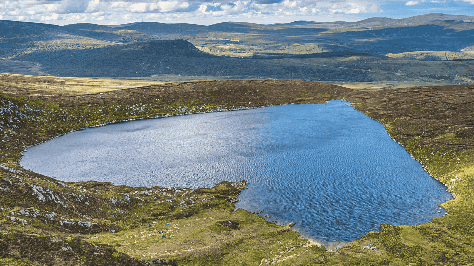
A few weekends ago, I found myself craving an adventure—a proper escape from the usual routine. That’s when a friend mentioned Lough Ouler, a heart-shaped lake tucked away in the Wicklow Mountains. I’d seen photos on Instagram, but they didn’t prepare me for what was ahead.
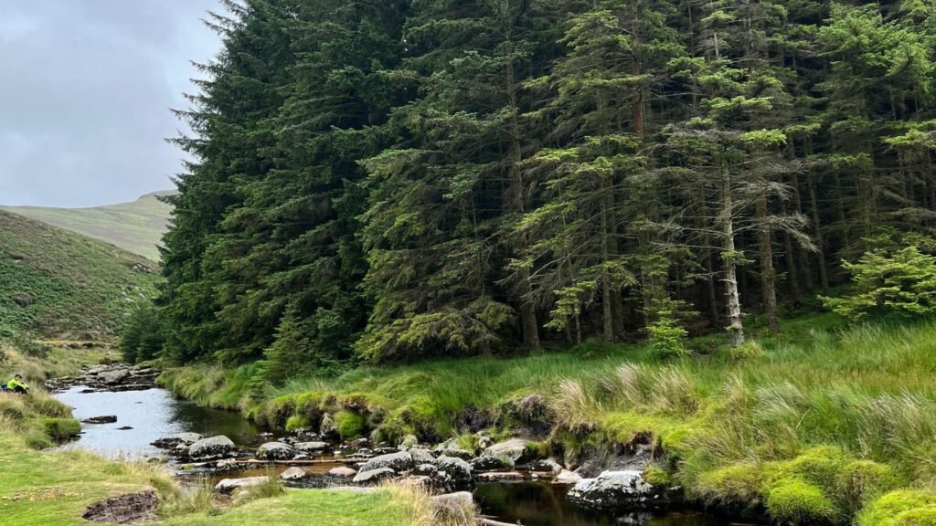
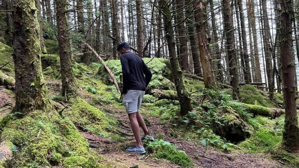
The trail starts quietly, weaving through rugged hills and heather-covered paths. With every step, the noise of everyday life fades, replaced by the sound of nature—birds, the crunch of your boots, and the distant rustle of the wind.
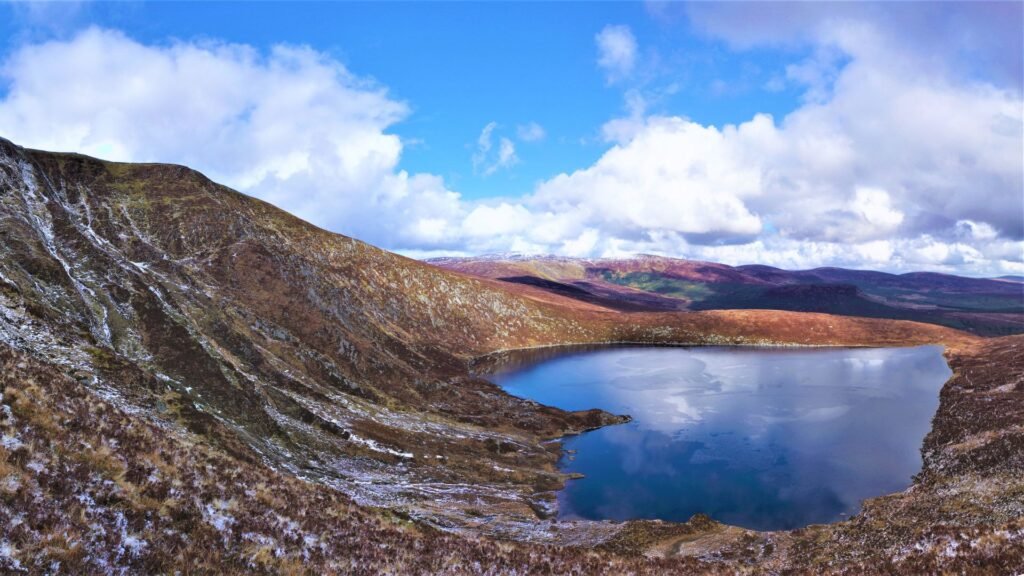
And then, just when you think the climb couldn’t offer anything more, the view of Lough Ouler opens up. It’s peaceful, untouched, and a reminder of why places like this are worth the effort.
Quick need-to-know tips for Lough Ouler
Location
Lough Ouler is located in the heart of the Wicklow Mountains, just a short drive from Dublin, making it an ideal day trip for anyone looking to explore Ireland’s natural beauty.
I’ve included the Google Maps location below for easy navigation.
How to reach Lough Ouler?
The best way to reach Lough Ouler is by car. You can drive up here or even rent a car from Europe Car or Budget Car.
I have already mentioned the location on Goggle Map above. There’s also parking options. The road is so scenic, but please make sure that you drive safely as the road is narrow, allowing for two cars to pass at a time. Don’t speed up and be cautious as cars are coming up from the other side.
Parking at Lough Ouler
Depending on the hiking route you choose, there are two parking options at Lough Ouler Wicklow. The spaces are relatively big, so you won’t have to worry about parking.
However, during the peak summer season when you expect more people to explore, it may fill up quickly. But in that case, you can go up to the next parking as the only difference is that you end up picking the longer loop.
- Wicklow Gap Car Park: This is the most popular parking spot for those hiking to Lough Ouler via Tonelagee. It offers a large, free parking area, with easy access to the trailhead.
- Glenmacnass Waterfall Car Park: If you’re taking the more challenging circular route from Glenmacnass, you can park at this car park, which is close to the waterfall and the starting point for the hike.
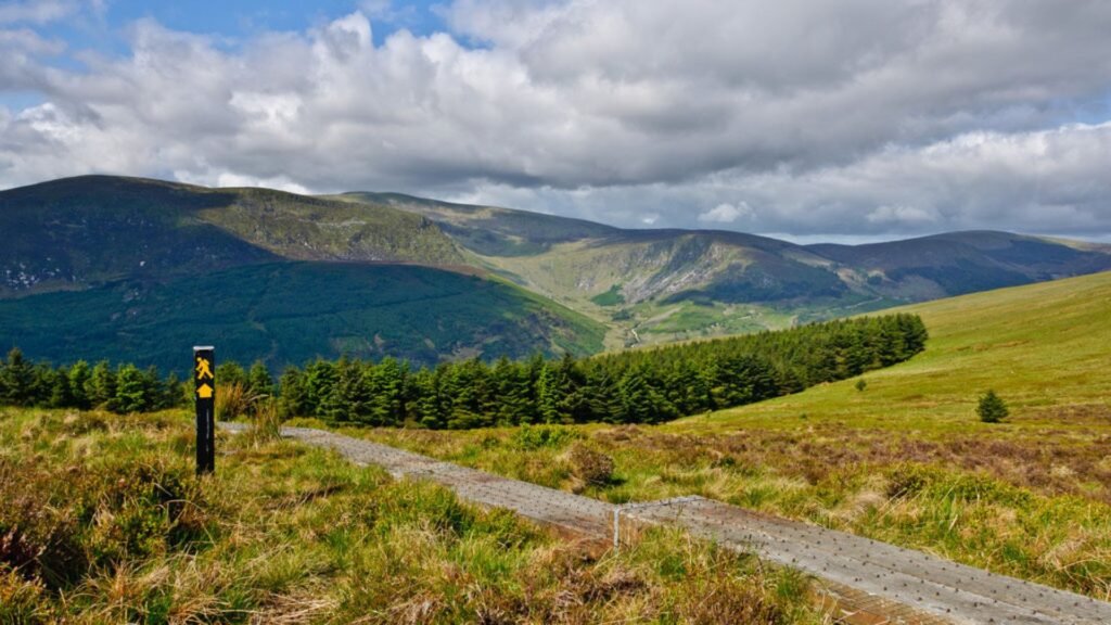
Hiking Lough Ouler
Tonelagee & Lough Ouler Trail
Starting Point: Wicklow Gap Car Park
What to Expect: A scenic route through Wicklow National Park, with views of Lough Ouler (heart-shaped lake) and a chance to summit Tonelagee, the third-highest peak in Wicklow.
Difficulty Level: Moderate
Duration: Approx. 3 hours round trip
Highlights: Panoramic views of the Wicklow Mountains and surrounding valleys. Be prepared for muddy terrain and moderate climbs.
The Loop from Glenmacnass
Starting Point: Glenmacnass Waterfall Car Park
Route Description: This is a more remote loop trail. It’s a longer hike compared to the direct route, taking you through more rugged and less-travelled terrain before reaching Lough Ouler Wicklow.
Duration: 4 to 5 hours round trip.
Difficulty: Challenging.
Highlights: Secluded hiking experience, stunning views of Glenmacnass Waterfall, and a different approach to Lough Ouler.
Safety Tips for Hiking in Wicklow
The Wicklow Mountains offer stunning landscapes but it’s always good to be prepared due to their rugged terrain and unpredictable weather. Here are essential safety tips to ensure a safe and enjoyable hiking experience:
- Check the Weather: Wicklow’s weather can change rapidly, even during summer. Check a reliable weather forecast on Met Éireann or Mountain Forecast to be able to enjoy stunning views.
- Wear Appropriate Gear: Waterproof jacket and pants. I had a terrible experience hiking up with my casual shoes, so make sure that you have hiking boots with good grip.
- Bottle of water: It’s a long hike so carrying a bottle of water is always recommended.
What to Expect on the Hike?
- Muddy and wet areas, especially after rain.
- Uneven, rocky sections that require careful footing.
- Occasional narrow paths with steep inclines.
- Panoramic views of the surrounding valleys and nearby peaks.
Other Attractions Near Lough Ouler
Glenmacnass Waterfall
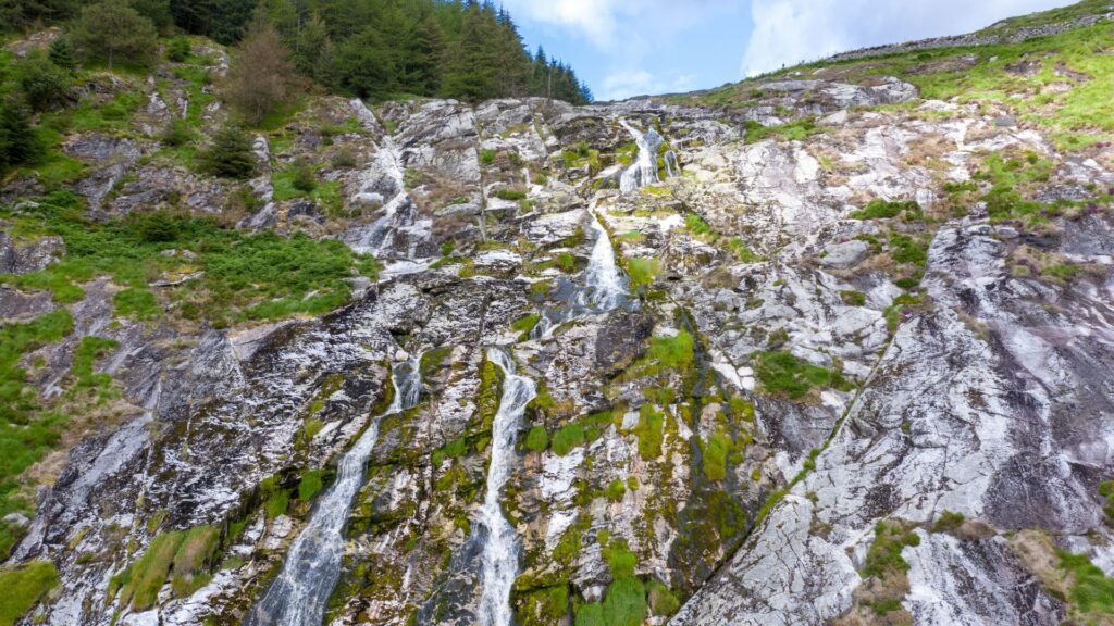
If you’re heading to Lough Ouler Wicklow, stop at Glenmacnass Waterfall, a breathtaking natural wonder nestled in the Wicklow Mountains.
This cascading waterfall, located in Glenmacnass Valley, is a short drive from the village of Laragh and offers a perfect detour for nature lovers and photographers alike. Below is its Google Maps location for your easy navigation.
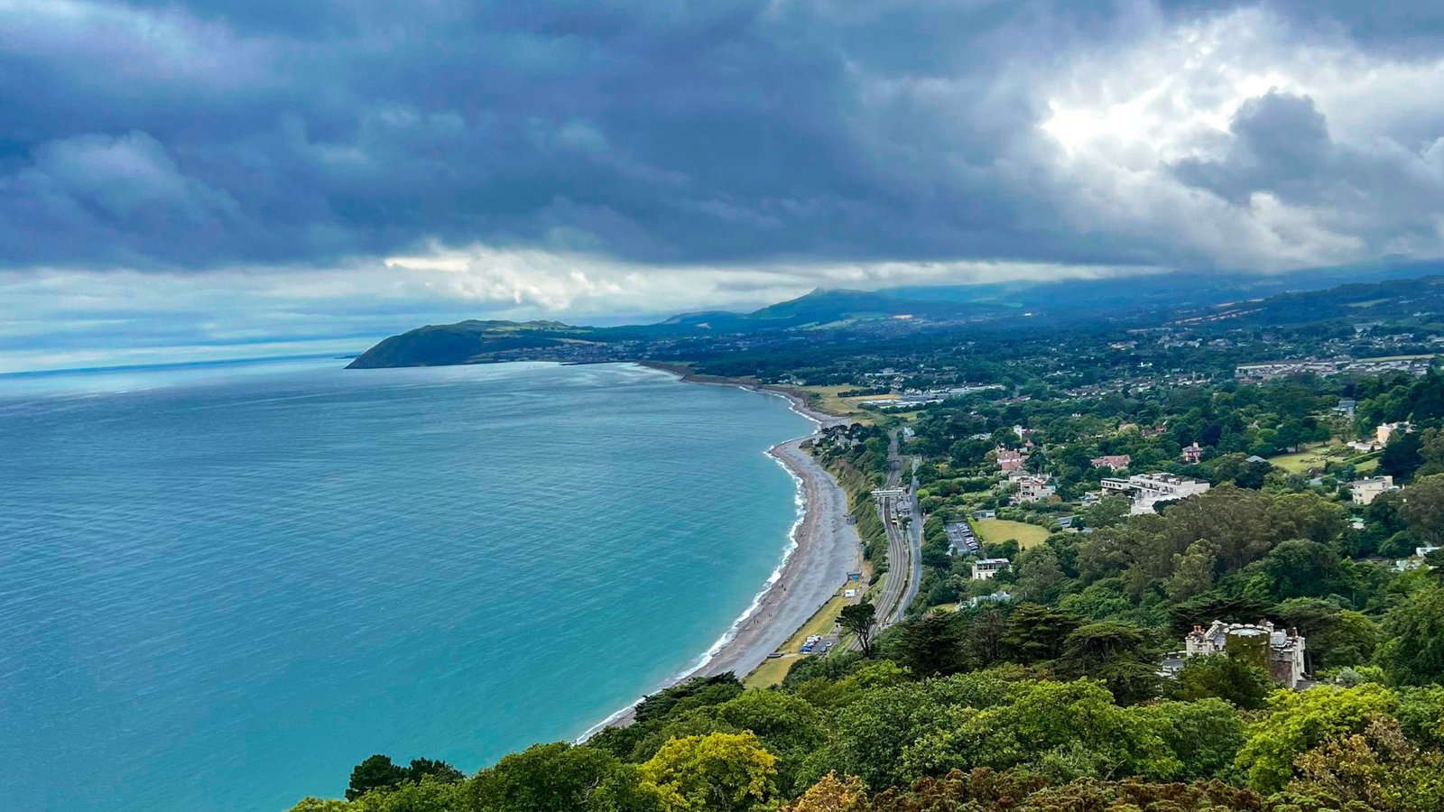
Wicklow Mountains scenic drives
The Wicklow Mountains offer some of the most breathtaking scenic drives in Ireland, perfect for anyone who loves the open road and dramatic landscapes.
These routes wind through rugged peaks, serene lakes, and picturesque valleys. After driving this route you’ll realize why Wicklow is called “Garden of Ireland.”
Frequently Asked Questions (FAQs)
How long does it take to hike to Lough Ouler?
The hike to Lough Ouler via Tonelagee Mountain typically takes around 2.5 to 3 hours round trip, depending on your pace and fitness level. If you take the more challenging route via Glenmacnass Waterfall, expect a 4 to 5-hour round trip.
Is the trail to Lough Ouler suitable for beginners?
The trail via Tonelagee is considered moderate and is suitable for beginners with a basic level of fitness. However, some sections can be steep and boggy, so proper hiking boots and preparation are recommended. The Glenmacnass route is more challenging and better suited for experienced hikers.
What is the best time of year to visit Lough Ouler?
The best time to visit is between April and August, when the weather is more favorable, and the trails are less muddy. Early mornings or weekdays offer a quieter experience with fewer crowds.
Where can I park for the Lough Ouler hike?
For the Lough Ouler hike, you can park at either:
- Wicklow Gap Car Park for the Tonelagee route (free parking).
- Glenmacnass Waterfall Car Park for the more challenging route (also free).
Arrive early on weekends to secure a spot, as these car parks can fill up quickly.
Conclusion
If you’re craving an adventure that’s off the beaten path, where every step brings a new view and a deeper sense of peace, Lough Ouler is waiting.
Hope you enjoyed reading this guide. If you have any more questions, please comment below and also share your experience with me if you’ve visited here. Have fun and be safe!

2 Comments