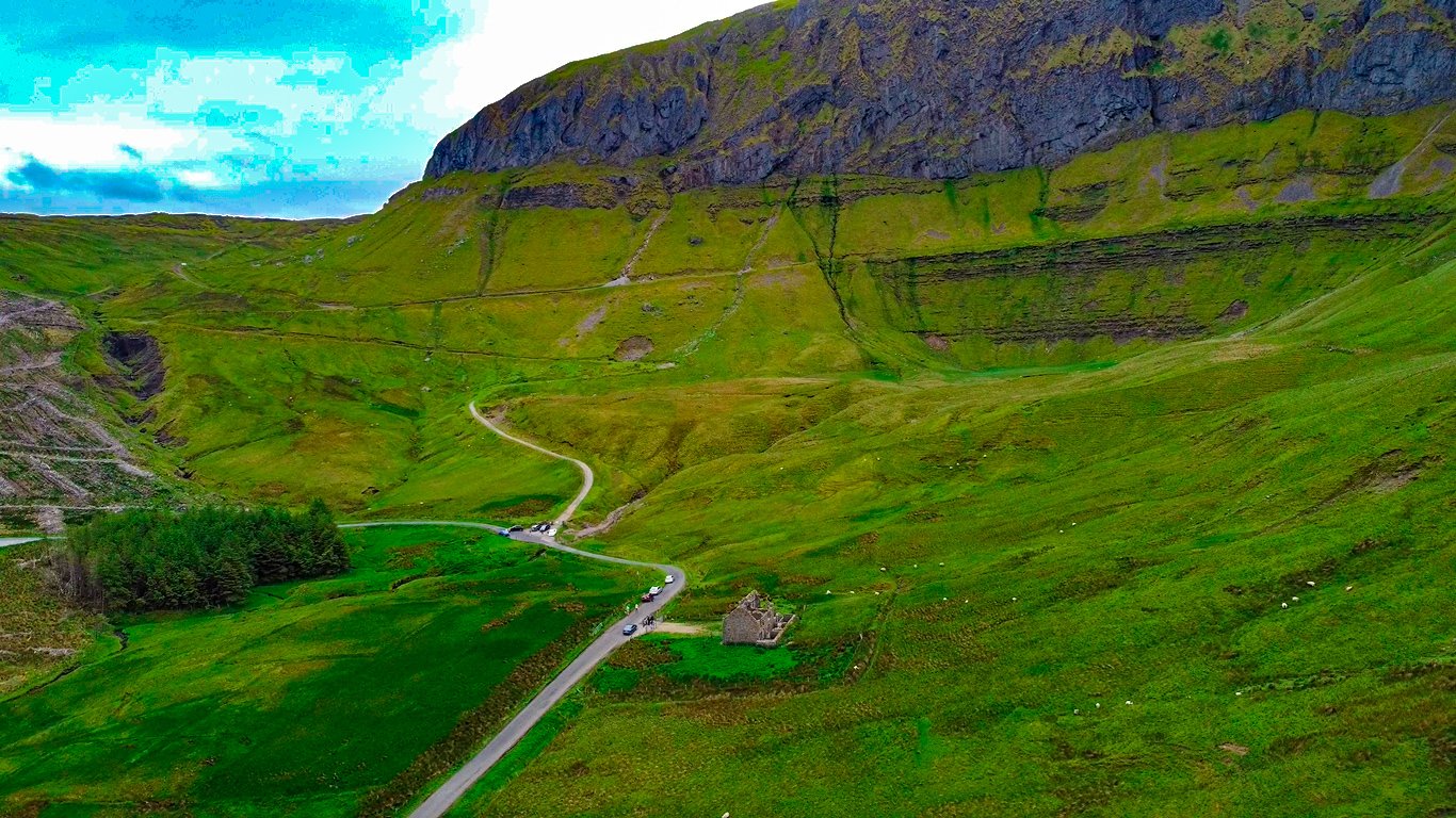
Tucked away in the heart of the Wicklow Mountains, Guinness Lake felt like stepping into a postcard in my visit. The drive up the Military Road was scenic, but nothing prepared me for the view at the Lough Tay Viewing Point.
The lake stretched out below, dark and still, with its white sandy shoreline making it look like a pint of Guinness from above. I parked nearby and took a short walk to the best viewpoint. It’s an easy spot to reach, even if you’re not planning to hike, though there are plenty of trails if you’re up for it.

It’s a place where you can take a moment to breathe, snap a few photos, and just enjoy the beauty of the Irish countryside. If you’re visiting Wicklow, Lough Tay is well worth the trip.
Quick need-to-know tips to Guinness Lake
Location
Lough Tay (Guinness Lake) is located in County Wicklow, Ireland, about an hour’s drive south of Dublin. It sits within the Wicklow Mountains National Park.
The lake lies along the famous Military Road, which offers some of the most breathtaking views in the region and connects key points like Sally Gap and Glenmacnass Waterfall
I’ve included the Google Maps location below for easy navigation.
Safety Tips
- Stay on Marked Trails: Stick to designated trails like the Luggala Loop or Djouce Mountain Trail to avoid getting lost or venturing too close to dangerous cliff edges.
- Avoid the Cliffs: Be cautious, especially during wet or windy weather when paths can be slippery.
- Parking and Road Safety: The Military Road is narrow and can be busy with both tourists and cyclists. Be cautious when parking and walking along the roadside.
- Weather Conditions: Be prepared and wear waterproof jackets and appropriate shoes.
Parking
For the Lough Tay car park, it’s important to know where to stop as the lake itself is on private land and not directly accessible.
JB Malone Car Park: It’s the best option as it’s just a short walk from here to one of the main viewpoints overlooking Lough Tay.
Lough Tay Viewing Point: It offers limited parking and can fill up quickly but provides a stunning, elevated view of the lake and the surrounding Wicklow Mountains.
Lough Tay Hike
Lough Tay Walk offers some of the most scenic hiking trails in County Wicklow, with routes that take you through stunning landscapes and breathtaking viewpoints.
Luggala Loop Hike
- Start: The hike typically begins near Pier Gates, a gated entrance to the private Luggala Estate on the Military Road (R759).
- Distance: Approximately 10 km (6.2 miles)
- Duration: 3 to 4 hours
- Difficulty: Moderate to challenging due to steep ascents and uneven terrain
- Highlights: Stunning views from the Luggala Mountain Summit and vistas over Lough Tay, Lough Dan, and the Wicklow countryside.

Djouce Mountain Trail
- Start: JB Malone Memorial Car Park, located along the Military Road.
- Distance: 8-10 km round trip
- Duration: 2 to 3 hours
- Difficulty: Moderate, with some elevation gain but less challenging than Luggala.
- Highlights: Panoramic views from the summit of Djouce Mountain, making it one of the most rewarding routes for a Lough Tay walk.
Knocknacloghoge and Lough Dan Hike
- Start: The hike typically begins near Oldbridge, close to the Lough Dan Scout Centre.
- Distance: Around 7 km (4.3 miles)
- Duration: 3 hours
- Difficulty: Moderate, with a mix of forest tracks and open moorland.
- Highlights: Views of both Lough Tay and the fewer crowds.
Lough Tay Viewing Point
Main Viewpoint
Location: Along the Military Road (R759), this is the most popular and easily accessible viewpoint for Lough Tay.
Highlights: Offers a bird’s-eye view of Lough Tay and you can see the Luggala Mountain.
Tips: Parking is limited, so arrive early, especially on weekends.
JB Malone Memorial Viewing Point
Location: Situated along the Wicklow Way near the JB Malone Memorial.
Highlights: Provides panoramic views and the surrounding Wicklow Mountains.
Tips: There are benches nearby, making it a good spot for a picnic or a break.

Luggala Summit Viewpoint
Location: Accessible via the Luggala Loop Trail, this viewpoint is situated near the summit of Luggala Mountain.
Highlights: Offers a 360-degree view of Lough Tay, Lough Dan, and the surrounding peaks and valleys.
Tips: Suitable for experienced hikers due to the steep ascent.
Frequently Asked Questions (FAQs)
Are there any attractions to visit near Lough Tay Guinness Lake?
Yes, several attractions nearby, including Sally Gap Drive, Glenmacnass Waterfall, Powerscourt Waterfall, and Glendalough Monastic Site.
Check my detailed guide to Powerscourt Waterfall for more tips and information.
How do you get to Lough Tay from Dublin?
It is approximately an hour’s drive from Dublin. Take the M50 south, then exit onto the N11 toward Roundwood/Glendalough. From there, follow the signs for the Military Road (R759) to reach the viewpoints near the lake
Is it safe to hike around Lough Tay?
Yes, but be cautious:
- Stick to marked trails.
- Avoid getting too close to cliff edges, especially during wet or windy weather.
- Bring proper hiking gear and check the weather before setting out.
Is there parking near Lough Tay Guinness Lake?
Yes, the main parking options include: JB Malone Car Park and Lough Tay Viewing Point with limited spaces.
Where is the best place to view Lough Tay?
The best viewpoints are: Lough Tay Viewing Point, JB Malone Memorial and the summit of Luggala Mountain for panoramic views.
Conclusion
Lough Tay Guinness Lake is a hidden gem nestled in the heart of the Wicklow Mountains, offering you a chance to experience some of Ireland’s most dramatic natural beauty.
Hope you enjoyed reading this guide. If you have any more questions, please comment below and also share your experience with me if you’ve visited here. Have fun and be safe!


4 Comments